
180628151749_1_540x360
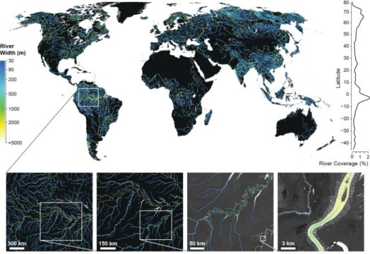
The Global River Widths from Landsat (GRWL) Database contains over 58M measurements of planform river geometry. Line plot at right shows observed river coverage as a percentage of land area by latitude, and insets show GRWL at increasing spatial scale. Rightmost inset shows GRWL orthogonals over which river width is calculated with only every 8th orthogonal shown for clarity.
Credit: UNC-Chapel Hill
Be the first to comment