18 April, 2018 in Forecasting and Warning Systems
LONDON, April 13 (Thomson Reuters Foundation) – The director of the U.S. National Hurricane Center said new ways of forecasting extreme weather events, including identifying storms before they fully develop, mark a “huge leap forward in the science of hurricanes”.
Kenneth Graham, who chaired a meeting this week of the World Meteorological Organization’s (WMO) Hurricane Committee, saw the difference a trial version of the technology made last year when he coordinated the emergency response to Hurricane Nate in New Orleans.
“It gave our emergency services and first responders almost a whole extra day to prepare for the surge, the rain and the wind,” said Graham, who took up his post earlier this month.
He said the technology would be used in the rest of the United States this year.
The tropical cyclone monitoring system was one of several forecasting products that were presented and tested at the WMO meeting on the Caribbean island of Martinique.
The gathering saw more than 50 meteorologists and disaster management officials review last year’s hurricane season, which wrought havoc across the Caribbean and southern U.S. states, in an effort to share experiences and plan ahead.
Graham told the Thomson Reuters Foundation that 2017 was an “historic hurricane season”. It was the first time three Category 4 hurricanes – Harvey, Irma and Maria – had landed in the United States in a season.
They caused damage exceeding $250 billion.
According to the WMO, 227 people were killed in the United States and the Caribbean, and millions were affected. Recovery for the worst-hit Caribbean countries, such as Dominica, could take years, the agency said in a statement.
Aside from finding ways to improve forecasting, said Graham, the National Hurricane Center was also assessing how to raise public awareness of risks before this year’s storm season starts.
The Atlantic hurricane season runs from June through November.
Water Threats
Graham said the National Hurricane Center wanted to make people better aware of the range of risks hurricanes bring, most importantly that of water.
“Most people immediately think of wind when they visualise a hurricane,” he said.
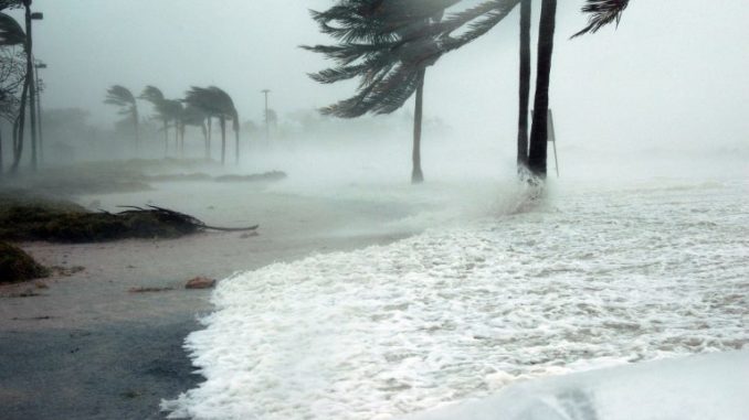
“But the reality is multiple hazards – wind, heavy rain and storm surge,” he said, adding that water accounts for about 90 percent of hurricane-related deaths in the United States.
Cutting the number of indirect deaths, of which there were 85 in the United States last year, is also a focus; those can vary from being killed by a falling tree to electrocution from generators in homes.
“We will be aggressively communicating before, during and after a hurricane about the caution associated with those indirect fatalities,” he said.
Another key area is linking the physical science of modelling hurricanes to the social sciences that assess human behaviour.
“That is going to be our focus. If we can connect the two, then we can really save lives,” he said.
Reporting by Isabelle Gerretsen; Editing by Megan Rowling and Robert Carmichael, for the Thomson Reuters Foundation, the charitable arm of Thomson Reuters.
Source: http://floodlist.com/forecasting-warning-systems/new-storm-forecasting-methods-mark-huge-leap-forward-us-official

Be the first to comment