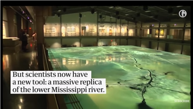
At twice the size of a regulation basketball court, the enormous replica will be used to work out an ambitious water-diversion plan
Scientists working to stop rising seawater damaging the fragile ecosystems of the Louisiana coastline have unveiled a massive new weapon: an enormous replica of the lower Mississippi delta.
At some 10,800 sq ft, the model is more than twice the size of a regulation basketball court. Housed at Louisiana State University’s center for river studies,the “Lower Mississippi River Physical Model” will help experts work out how best to enact a state plan to fight coastal erosion.
The plan calls for diverting nutrient-rich river water from the Mississippi into marshes and wetlands that in recent years have been inundated with salty water from the Gulf of Mexico. Researchers hope that such infusions will reverse some of the devastation the salt water has caused as it has killed off animal and plant life.
Clint Willson, the LSU professor who heads the Center for River Studies, said researchers would be able to study “the flows and the water stages of the water levels in the Mississippi river”.
“We can also model or simulate the transport or the movement of the Mississippi river sand down the river, and we can do all that in roughly one hour to replicate one year on the river.”
Seawater encroachment has not just damaged wetlands – in many places it has erased them completely. According to Rudy Simoneaux of the state’s coastal protection and restoration authority, Louisiana is estimated to have lost 2,000 sq miles of coastline since the 1930s. That is an area roughly the size of Delaware.
The LSU model cost $4m and is housed a stone’s throw from the actual Mississippi river in Baton Rouge. Among questions that researchers hope it will help to answer are: how will opening one diversion affect the river’s flow? How will diversions affect dredging done by the US army corps of engineers? How will multiple diversions along the river affect each other?
“What you do in one place has an impact on another,” said Willson, “and so the idea of looking at larger-scale impacts or larger-scale processes is critical to looking at what the potential impacts are or the unintended consequences of projects, and so a model of this scale allows you to do that.”
The Associated Press contributed to this report.
Visits: 2

After distroying it, we spent much more effort to recover it.